FORT ST JOHN, B.C. - Residents across Northeast B.C. can expect a significant warm-up this week, with temperatures climbing steadily after several days of cooler, unsettled weather that brought rain, cloud cover and below-seasonal temperatures to parts of the Peace Region.
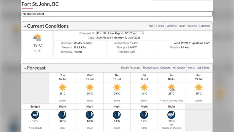
Forecasts for Fort St. John and Dawson Creek show daytime highs rising from the low 20’s on Monday into the low 30’s on Friday, with sunshine and dry conditions becoming more widespread.
Environment Canada is forecasting highs of 28 C Wednesday and 29 C on Thursday. The warming trend is expected to continue through the latter part of the week.
The return of sunshine follows a period of unsettled weather that saw periods of rain, showers and daytime highs sitting in the upper teens to low 20s across much of the region. Environment Canada reported a high of 18 C for the Fort St. John area on Sunday before temperatures began rebounding Monday.
Weather models suggest the warmest conditions of the week will arrive Thursday and Friday, with abundant sunshine and little chance of precipitation. Overnight temperatures are also expected to increase, providing warmer mornings than residents have seen in recent days.
The forecast points to a more typical mid-summer pattern across the Peace Region, offering a welcome change for those eager to enjoy outdoor activities after a stretch of cool, damp weather.